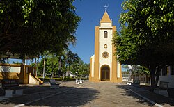
Borá
Borá | |
|---|---|
 | |
 Location in São Paulo state | |
| Coordinates: 22°16′14″S 50°32′41″W / 22.27056°S 50.54472°W | |
| Country | Brazil |
| Region | Southeast |
| State | São Paulo |
| Founded | 1918 |
| Recognized | 1934 |
| Government | |
| • Mayor | Luiz Carlos Rodrigues [1] (PTB) |
| Area | |
| • Total | 119 km2 (46 sq mi) |
| Population (2020 [2]) | |
| • Total | 838 |
| • Density | 7.0/km2 (18/sq mi) |
| Time zone | UTC−3 (BRT) |
Borá is a municipality in the state of São Paulo in Brazil. The population is 838 (2020 est.) in an area of 119 km².[3] The elevation is 582 m. Borá is the least populated municipality in São Paulo and the second least populated in Brazil.[4] Its foundation dates from around 1918, with the merchant Vedovatti family, being formally recognized in 1934, and becoming a municipality in 1965.[5]
Media
[edit]In telecommunications, the city was served by Companhia de Telecomunicações do Estado de São Paulo until 1973, when it began to be served by Telecomunicações de São Paulo.[6] In July 1998, this company was acquired by Telefónica, which adopted the Vivo brand in 2012.[7]
The company is currently an operator of cell phones, fixed lines, internet (fiber optics/4G) and television (satellite and cable).[7]
Religion
[edit]Christianity is present in the city as follows:
Catholic Church
[edit]The Catholic church in the municipality is part of the Roman Catholic Diocese of Assis.[8]
Protestant Church
[edit]The most diverse evangelical beliefs are present in the city, mainly Pentecostal, including the Assemblies of God in Brazil (the largest evangelical church in the country),[9][10] Christian Congregation in Brazil,[11] among others. These denominations are growing more and more throughout Brazil.
See also
[edit]- List of municipalities in the state of São Paulo by population
- List of municipalities in the state of São Paulo by area
References
[edit]- ^ Globo Archived 2012-10-04 at the Wayback Machine
- ^ IBGE 2020
- ^ Instituto Brasileiro de Geografia e Estatística
- ^ Estadão Archived April 19, 2010, at the Wayback Machine.
- ^ "História".
- ^ "Creation of Telesp - April 12, 1973". www.imprensaoficial.com.br (in Portuguese). Retrieved 2024-05-26.
- ^ a b "Our History - Telefônica RI". Telefônica. Retrieved 2024-05-26.
- ^ "Sul 1 Region of Brazil [Catholic-Hierarchy]". www.catholic-hierarchy.org. Retrieved 2024-07-22.
- ^ "Campos Eclesiásticos". CONFRADESP (in Portuguese). 2018-12-10. Retrieved 2024-07-22.
- ^ "Arquivos: Locais". Assembleia de Deus Belém – Sede (in Portuguese). Retrieved 2024-07-22.
- ^ "Localidade - Congregação Cristã no Brasil". congregacaocristanobrasil.org.br (in Portuguese). Retrieved 2024-07-22.
External links
[edit]- Borá municipality webpage in Brazilian Portuguese

